According to a July 2012 estimate, the population of Saskatchewan is 1,079,958.
Currently, Saskatchewan’s population makes up approximately 3.1% of the Canadian national population. With a 6.7% population growth, Saskatchewan is the sixth most populated Canadian province, after Ontario (1), Quebec (2), British Columbia (3), Alberta (4), and Manitoba (5).
Saskatchewan Land Area
The land area is 591,670 km^2, or 228,445 mi^2, making Saskatchewan the seventh largest province by land mass, after Nunavut, Quebec, Northwest Territories, Ontario, British Columbia, and Alberta.
Saskatchewan makes up approximately 6.5% of Canada’s entire area and has a water area of 59,366 km^2, or 22,921 mi^2.
Saskatchewan Borders
West of Saskatchewan is Alberta province, while east is Manitoba province. North of Saskatchewan is the Northwest Territories, while the north-east is Nunavut. The southern border of Saskatchewan are the U.S. States Montana and North Dakota.
Saskatchewan is part of the Western Provinces. Saskatchewan is one of two Canadian provinces that are land-locked. In addition, Saskatchewan is the only Canadian province in which its borders do not correspond to physical geographic features. Rather, Saskatchewan’s borders are all based on geographic coordinates of longitude and latitude. The province is shaped like a quadrilateral. However, because of its size, on a map, the 49th latitude boundary and the 60th northern border appear curved instead of straight. The eastern boundary of Saskatchewan is partially crooked rather than straight because the surveyors and homestead program corrected it from 1880-1928.
 Saskatchewan Capital
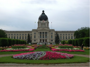
The capital of Saskatchewan is Regina, with a population of 193,100. The city is 2nd largest in Saskatchewan and is a cultural and commercial center. Regina’s most famous attraction is the Provincial Legislative Building, followed by the University of Regina, the Provincial Museum of Natural History, the Regina College Conservatory, the Saskatchewan Science Centre, and the Saskatchewan Centre of the Arts.
Saskatoon, located on the South Saskatchewan River, is the biggest city in Saskatchewan. One of the main attractions is Meewasin Valley Trail. Saskatoon has countless famous shopping malls, universities, and hospitals. Those who live in Saskatoon call themselves “Saskatonians.”
Saskatchewan Federal Representation
Saskatchewan holds 14 of the 308 House of Commons seats, thus making up 4.5% of the total percentage.
Saskatchewan holds 6 of the 105 Senate Seats making up 5.7% of the total.
Saskatchewan Economic Statistics
Saskatchewan’s economy used to be more agriculturally-based; however, an increase in diversity has resulted in agriculture, and forestry making up 6.8% of Saskatchewan’s GDP. Now, finance (17.1%), mining/petroleum (13%), and education, health, and social services (11.9%) are the top three economic sectors of Saskatchewan.
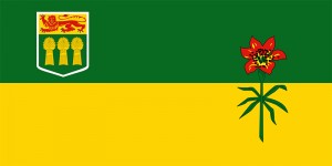
Wheat is the most common crop in Saskatchewan; it is even depicted on Saskatchewan’s coat of arms. However, in general, a wide range of grains are grown in Saskatchewan, including rye, barley, flax, and canola. Beef cattle industry in Saskatchewan is 2nd to Alberta, as well as oil and natural gas production. Saskatchewan is the world’s largest exporter of potash and uranium.
Saskatchewan’s GDP in 2006 was approximately $45.9 billion.
Interactive Canadian Province Population Map
Saskatchewan Historical Population Statistics
| Year | Population |
| 1901 | 91,279 |
| 1911 | 492,432 |
| 1921 | 757,510 |
| 1931 | 921,785 |
| 1941 | 895,992 |
| 1951 | 831,728 |
| 1961 | 925,181 |
| 1971 | 926,242 |
| 1981 | 968,313 |
| 1991 | 988,928 |
| 1996 | 976,615 |
| 2001 | 978,933 |
| 2006 | 985,386 |
| 2011 | 1,053,960 |
Other Resources
To learn more about the population of Saskatchewan, click here
Learn more about Manitoba Population


